
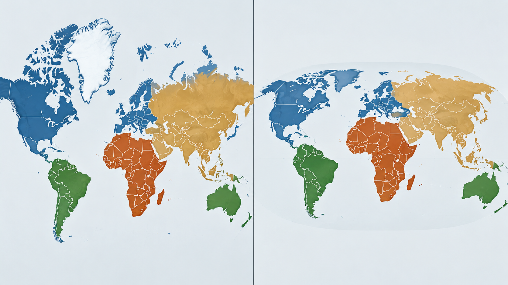
Illustration: AI-generated with OpenAI
BBC reported that the United Nations General Assembly has voted to support a new world map that shows Africa’s true size more accurately.
The “Correct the Map” resolution was sponsored by Togo and backed by African Union members.
A total of 164 countries voted in favour. France and the United Kingdom were among them.
The United States was the only country to vote against the resolution. Six countries abstained.
The decision challenges the Mercator projection, a map that has been widely used around the world for centuries.
Why does Africa look smaller on world maps?
The Mercator projection was created by Flemish cartographer Gerardus Mercator in 1569.
It was designed to help sailors navigate around the world. However, it does not accurately show the relative sizes of continents.
This happens because the Earth’s curved surface cannot be perfectly represented on a flat map.
As a result, the Mercator projection makes areas near the poles appear much larger. Areas closer to the equator appear smaller by comparison.
Africa is one of the clearest examples.
On a Mercator map, Greenland can appear almost as large as Africa.
In reality, Africa covers about 30.4 million square kilometres. Greenland covers about 2.2 million square kilometres.
That means Africa is roughly 14 times larger than Greenland.
New map shows Africa’s true size
The resolution supports the Equal Earth projection.
Cartographers developed the map in 2018 to provide a more accurate representation of the relative sizes of countries and continents.
Under this projection, Africa appears much larger compared with Greenland, Europe and other regions than it does on a Mercator map.
The African Union’s 54 member states backed the Equal Earth projection earlier this year. The AU said it provides a more accurate representation of continents, particularly Africa.
Togolese Foreign Minister Robert Dussey has also argued that the way maps portray countries can influence how people view the world.
Ahead of the vote, he summed up the campaign with a simple message: “A fair world begins with a fair map.”
What will the UN vote change?
The resolution is non-binding.
Therefore, countries are not legally required to stop using the Mercator projection.
However, the vote could encourage international institutions and other organisations to use maps that represent the relative sizes of continents more accurately.
Supporters of the campaign say the issue goes beyond geography.
They argue that showing Africa’s true size can help change long-standing perceptions about the continent and its place in the world.