
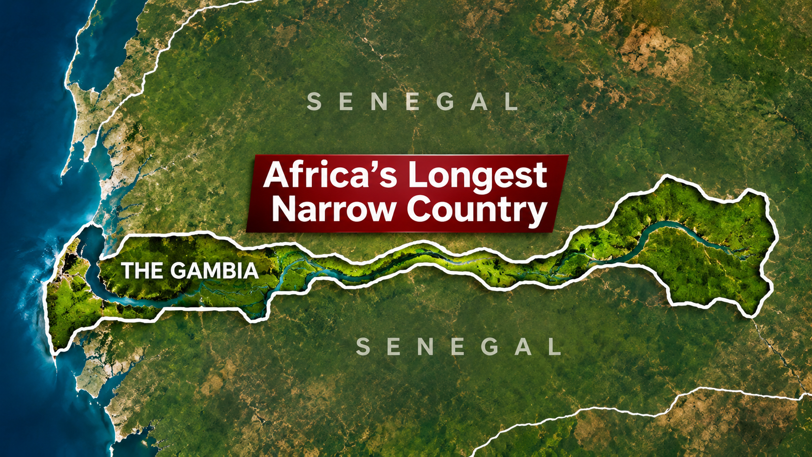
The Gambia has one of the most unusual shapes of any country in Africa. On a map, it looks like a long, narrow strip of land stretching deep into Senegal.
But why does the country have such an unusual shape?
The answer lies in the River Gambia, European colonial history and the borders drawn during the 19th century.
A country shaped by a river
The Gambia is the smallest country on mainland Africa, covering approximately 11,300 square kilometres.
Its territory stretches roughly 480 kilometres inland from the Atlantic Ocean.
However, much of the country is only around 25 to 50 kilometres wide.
The River Gambia runs through the country’s centre before reaching the Atlantic Ocean near the capital, Banjul.
As a result, the country resembles a narrow ribbon wrapped around the river.
Senegal surrounds The Gambia on three sides. Only its western coastline opens onto the Atlantic.
How colonial powers shaped its borders
The Gambia’s unusual borders largely developed from competition between Britain and France.
During the colonial period, Britain controlled territory along the River Gambia. Meanwhile, France expanded its influence across the surrounding region, including present-day Senegal.
Both powers valued the river as a route for transport and commerce.
In 1889, Britain and France reached an agreement defining much of the boundary between their territories.
The agreement left Britain with a narrow corridor along the river, while France controlled the surrounding land.
Consequently, the modern country’s shape reflects colonial negotiations rather than natural geographic boundaries alone.
Did a British cannon determine the border?
One popular story claims that British ships sailed along the River Gambia and fired cannons in both directions.
According to the legend, the distance travelled by the cannonballs determined the country’s width.
It is a memorable explanation for The Gambia’s narrow shape.
However, historians do not generally accept the cannonball story as a literal account of how the border was drawn.
The borders emerged through diplomatic agreements and colonial surveying.
Therefore, the cannonball explanation is better understood as a popular historical legend.
The river remains central to Gambian life
Although colonial history shaped the country’s borders, the River Gambia remains central to its geography and economy.
The river supports fishing, agriculture, transport and wildlife habitats.
It also connects communities across the country’s long east-west territory.
The Gambia gained independence from Britain on February 18, 1965.
Today, its distinctive shape makes it one of Africa’s most recognisable countries on a map.
A remarkable African geography fact
The Gambia shows how rivers, geography and colonial decisions can influence the borders of modern nations.
Despite being surrounded almost entirely by Senegal, it has maintained its own national identity and independence.
Its unusual shape also offers a reminder that political borders do not always follow mountains, deserts or other natural barriers.
Sometimes, a country’s entire outline tells a much larger historical story.